Issue 13300
Species map tiles should be restricted by the boundary of a country, rather than showing tiles globally.
13300
Reporter: bko
Assignee: bko
Type: Improvement
Summary: Species map tiles should be restricted by the boundary of a country, rather than showing tiles globally.
Priority: Major
Resolution: Fixed
Status: Resolved
Created: 2013-06-11 12:31:35.926
Updated: 2013-11-11 16:57:05.723
Resolved: 2013-11-11 16:57:05.683

Description: Currently the Mapping API [1] only allows taxon or country as the parameter to retrieve tiles. To achieve this, the workaround could be to add another layer as the mask on the species tiles.

“Map of the GBIF country referred to the global map at the home page.”

[1] http://uat.gbif.org/developer/maps]]>
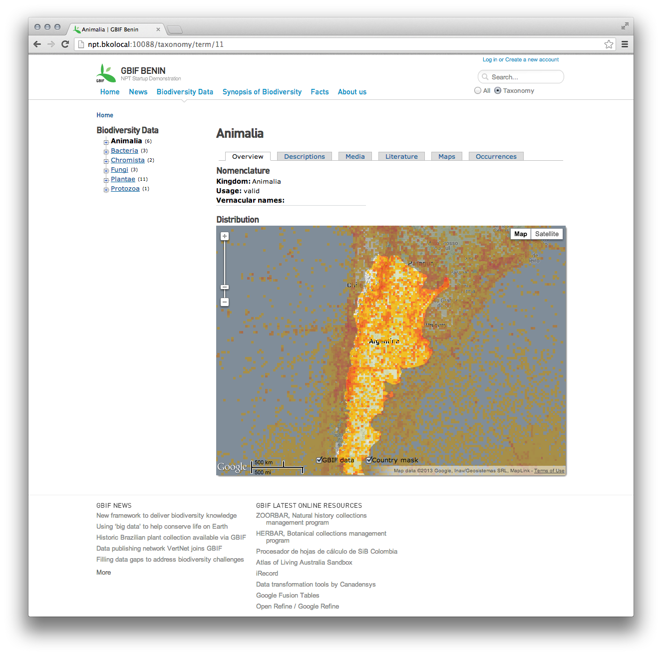
Attachment mask - Argentina.png
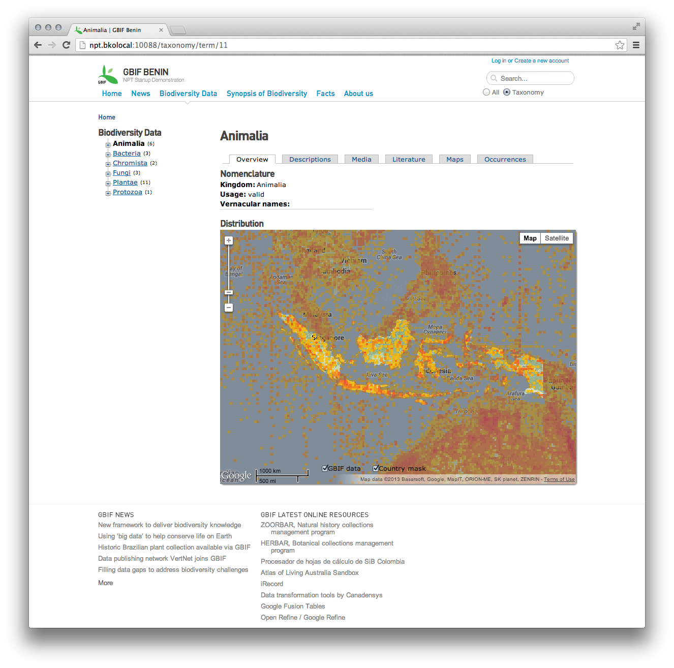
Attachment mask - Indonesia.png
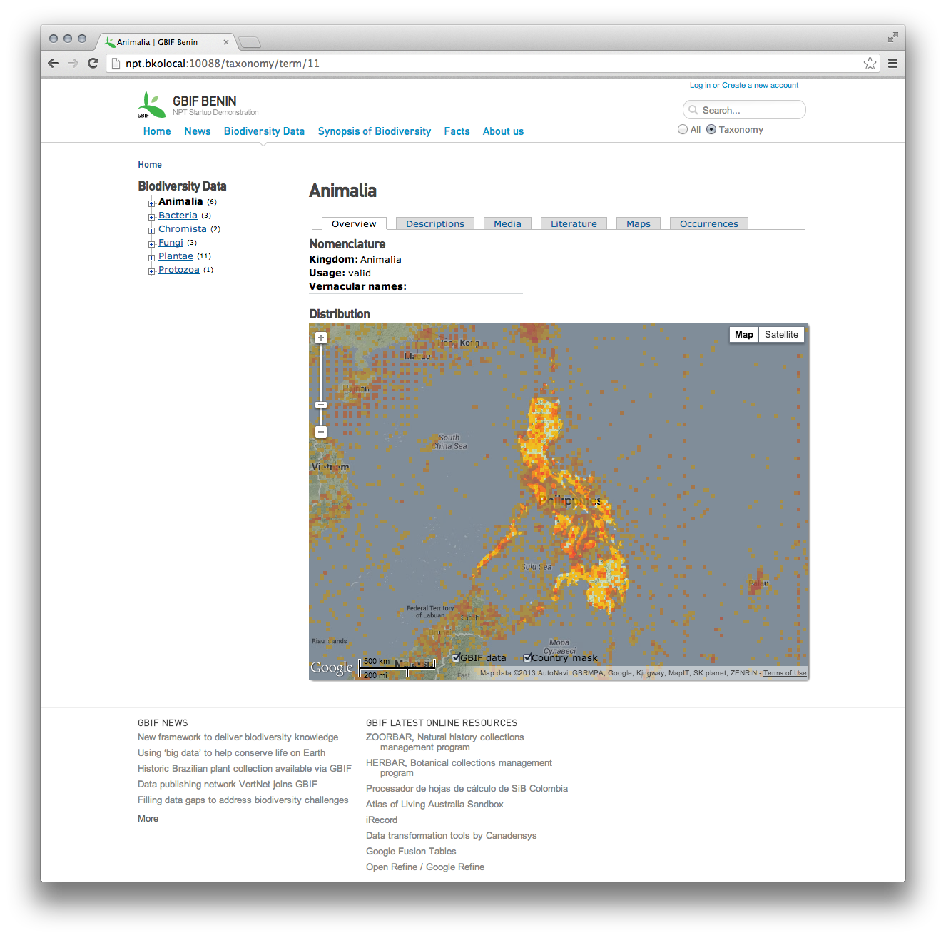
Attachment mask - the Philippines.png
Author: bko@gbif.org
Comment: 3 screenshots showing the masking now works for countries that have multiple polygon entries in the TDWG region(gm3_region_data).
Created: 2013-11-11 16:54:12.223
Updated: 2013-11-11 16:54:12.223
Author: bko@gbif.org
Created: 2013-11-11 16:57:05.723
Updated: 2013-11-11 16:57:05.723

The country mask is working and immediately reflect the country settings at admin/config/npt/settings.

This issue is now considered resolved.

To be further tested with all early adopter countries.