Issue 18105
Misleading display of occurrence polygon as a single point
18105
Reporter: rdmpage
Assignee: ahahn
Type: Feedback
Summary: Misleading display of occurrence polygon as a single point
Resolution: Duplicate
Status: Closed
Created: 2015-12-19 08:30:03.28
Updated: 2017-10-05 15:09:04.067
Resolved: 2017-10-05 15:09:04.046
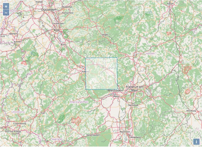
Description: The occurrences in this data set are polygons in WKT format (the data also contains the centre point of each polygon). The GBIF portal displays these occurrences as point localities, whereas they are fairly sizeable polygons - see attached screenshot for MULTIPOLYGON(((7.60206388888889 50.0938677383311,7.58881388888889 50.5434074870227,8.29440388888889 50.549817483425,8.30102388888889 50.1001777348173,7.60206388888889 50.0938677383311))) (based on http://openlayers.org/en/master/examples/wkt.html )
It would be great if the portal could display WKT as this gives the user a much better sense of what the data represents. This occurrence is not a single point locality at a single time, but summarises 10,000-99,999 observations in a rectangular area over more than two decades (1972-1995).
]]>
Attachment wkt.png
Author: hoefft
Comment: https://github.com/gbif/portal16/issues/577
Created: 2017-10-05 15:09:04.064
Updated: 2017-10-05 15:09:04.064