14222
Reporter: feedback bot
Assignee: thirsch
Type: Bug
Summary: Boundary of India incorrect
Priority: Critical
Status: Open
Created: 2013-10-14 13:12:35.844
Updated: 2016-02-27 08:34:47.462


Description: Kindly correct the boundary of India as it is incorrect as it depicts parts of India in Pakistan / China. Please resolve this at the earliest. Gautam node manager India

*Reporter*: Gautam Talukdar
*E-mail*: [mailto:gautam@wii.gov.in]]]>
Author: ahahn@gbif.org
Created: 2013-10-14 14:01:00.432
Updated: 2013-10-14 14:01:00.432

There are maps at
http://www.gbif.org/participation/summary
http://www.gbif.org/country/IN
Comparing against online map resources, I cannot immediately spot which parts are concerned.
Author: kbraak@gbif.org
Created: 2013-12-20 11:50:36.853
Updated: 2013-12-20 11:50:36.853

As we await clarification, I just wanted to state for the record that the boundaries shown on GBIF's maps do not imply any judgement on the part of GBIF concerning the legal status of any territory, or the endorsement or acceptance of such boundaries. This type of issue having to do with discrepancies in map boundaries, should actually be raised with the map suppliers, such as ESRI for example. For more information about the terms relating to maps and boundaries in the Portal, see http://www.gbif.org/disclaimer

Of course we still want to work with publishers to ensure that their data is properly represented with the caveat: that GBIF does not have the power to modify the boundaries shown in its maps.
Author: ahahn@gbif.org
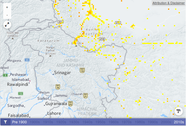
Comment: Proposal received from the reporter: could map layers be used as are displayed in GoogleMaps, showing contested boundaries in dashed lines? (attachment: screenshot from https://maps.google.de/)
Created: 2014-01-27 12:22:32.613
Updated: 2014-01-27 12:22:32.613
Author: mblissett
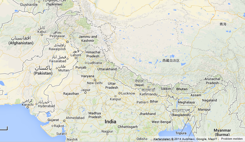
Comment: I assume this is the relevant region that is disputed between India and Pakistan. The "roads" map shows a solid border with the area part of India, but the geocoding service says Pakistan. The "terrain" map shows a dotted line.
Created: 2016-02-26 14:33:21.515
Updated: 2016-02-26 14:33:21.515
Author: mblissett
Created: 2016-02-26 14:34:23.402
Updated: 2016-02-26 14:34:23.402
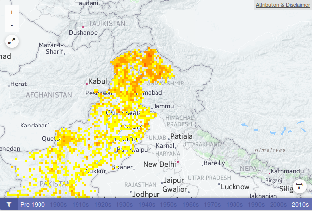
Here's the same for China and India.
Author: thirsch@gbif.org
Comment: Indeed. The problem here is that while maps can include ambiguity on disputed borders such as through dotted lines, the geocoding related to 'data about' a country needs a distinct choice on the part of GBIF about which boundary to use when returning the relevant records on a map. I agree with earlier comments that we should not be drawn into any discussion about the map representations but refer questions to the relevant institutions that compile the maps and state clearly (as we do in the disclaimer) that we are entirely neutral on these questions. With the geocoding choice, however, we need to be explicit about what informs the choice of boundaries when attaching data to one country or another. I'm not exactly sure which source we use for these geocoding boundaries, but perhaps it could also be referenced in the map disclaimer?
Created: 2016-02-26 15:16:51.335
Updated: 2016-02-26 15:16:51.335
Author: mblissett
Created: 2016-02-26 15:30:47.18
Updated: 2016-02-26 15:30:47.18

We use data from Marine Regions for the EEZs: http://marineregions.org/eezsearch.php

And Natural Earth for land: http://www.naturalearthdata.com/downloads/10m-cultural-vectors/

The Natural Earth data is pretty customizable.

I've been working on this, based on what we discussed a while back, and will probably ask you to take a look next week.
Author: thirsch@gbif.org
Comment: And I see they have a special section on disputed areas http://www.naturalearthdata.com/downloads/10m-cultural-vectors/10m-admin-0-breakaway-disputed-areas/
Created: 2016-02-27 08:34:47.462
Updated: 2016-02-27 08:34:47.462