Issue 18489
Show scale bar on occurrence detail and dataset page maps
18489
Reporter: kbraak
Type: Improvement
Summary: Show scale bar on occurrence detail and dataset page maps
Priority: Unassessed
Resolution: Fixed
Status: Closed
Created: 2016-05-23 17:04:26.614
Updated: 2016-06-15 16:12:21.471
Resolved: 2016-06-15 16:12:21.435

Description: Stephan H just raised the fact that a scale bar is missing from our maps.

To explain why it would be useful: He was validating some Dutch plot data. Where a centroid represents the location of a plot, the scale would allow you to determine if the reason a centroid(plot) is in the sea, is because it was obscured or not. Note Dutch vegetation plot and species occurrence locations get obscured to 5x5 km squares.

Note currently we cannot show polygons/plots on maps, work addressed in PF-2454.

An example scale bar from Google Maps attached. ]]>
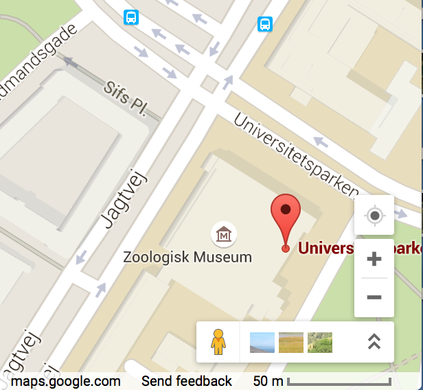
Attachment Screen Shot 2016-05-23 at 16.24.29.png
Author: hoefft
Comment: shown on new portals occurrence pages
Created: 2016-06-15 16:12:21.468
Updated: 2016-06-15 16:12:21.468