Issue 18505
Download list of locations (square plots) based on species combinations
18505
Reporter: kbraak
Type: NewFeature
Summary: Download list of locations (square plots) based on species combinations
Priority: Unassessed
Resolution: Duplicate
Status: Closed
Created: 2016-05-27 19:15:44.893
Updated: 2017-03-24 17:10:46.323
Resolved: 2017-03-24 17:10:46.195
Description: Allow users to search for and download a list of locations (e.g. 10x10 km UTM squares) matching a group of species.
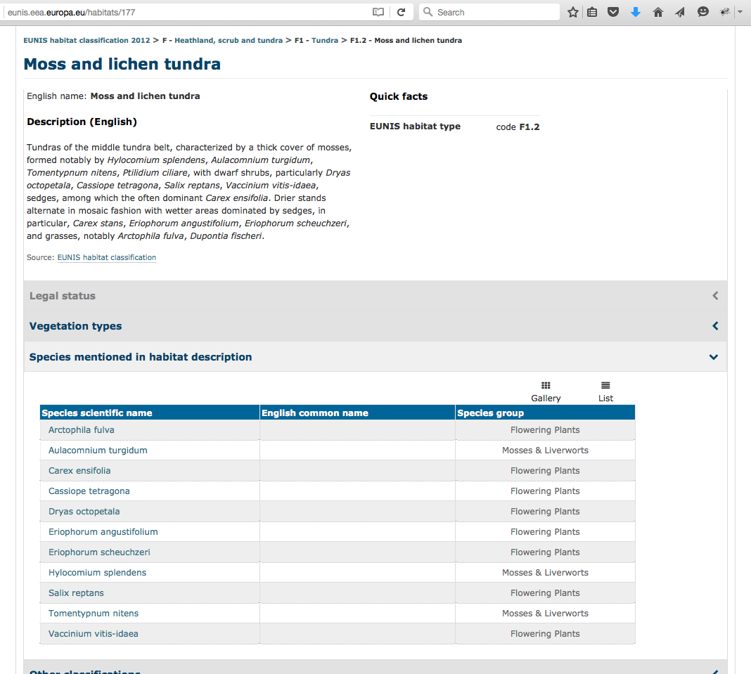
The group of species could represent an expert defined vegetation habitat type such as those described by [EUNIS|http://eunis.eea.europa.eu/habitats.jsp]. For example, ["Moss and lichen tundra"|http://eunis.eea.europa.eu/habitats/177] is described as having 11 species: 8 flowering plants, and 3 mosses and liverworts. (see list in attached screenshot).
This will allow users to predict where certain vegetation habitat types may occur. There is a need to extract information about plant communities across Europe in a standardized way, and this feature would fill this need.
Additional specifications:
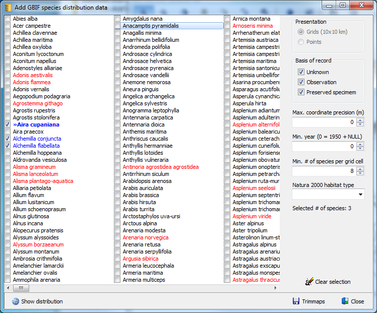
Rules for matching can be customized. For example, certain species can be selected as mandatory, meaning they must be included in the square for there to be a match. Alternatively, you could define a minimum number of species that must appear for there to be a match, e.g. 5 out of 9 species must be found within the square for there to be a match. See attached screenshots showing how this could look.
All matching locations (square plots) could also be shown on a heat map, allowing the results to be easily visualized.
Note Stephan H (Turboveg) brought this enhancement idea forward.]]>
Attachment IMG_26052016_120521.png
Attachment Screen Shot 2016-05-27 at 18.47.31.png
Author: kbraak@gbif.org
Comment: Issue transferred to https://github.com/gbif/portal16/issues/340 Closing issue as duplicate.
Created: 2017-03-24 17:10:46.268
Updated: 2017-03-24 17:10:46.268